
Important Notices for this Waterbody
| Notice |
|---|
| Chandler’s Mill Pond Rainfall totals from a February rain event, coupled with a large volume of snow melt from winter storms, resulted in extensive flooding in the Chandler’s Mill Pond watershed and a subsequent breach of the dam. In an effort to prevent additional damage, the breach was opened up further, the channel was stabilized, and planning and budgeting for repairs began. The plans and budget for this project are currently being finalized, after which contractors will proceed with emergency repairs to the breach and the addition of a second spillway to mitigate future damage to the dam. Until repairs are made, the Chandler’s Mill Pond will remained fully drawn down to allow repairs to be made in dry conditions. |
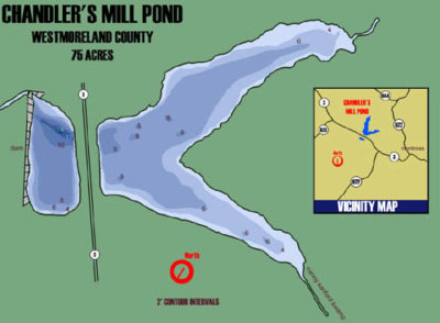
Chandler’s Millpond is a picturesque 75-acre impoundment located in Westmoreland County in the northeast of Virginia. The Sturman family originally built it around 1670 on Cat Point Creek. The pond is privately owned by several individuals, but the Department of Wildlife Resources has an agreement with them to allow public fishing.
The dam was completely redesigned and rebuilt following a failure in 2015. The reconstruction of the dam was completed in May of 2020. The redesign of the dam included extensive earthwork to ensure a solid foundation and a relocation of the spillway. The dam includes a multi-species pool and weir fishway that will provide access to 8 miles of habitat upstream including the impoundment. American Eel (catadromous) are the primary migratory species expected to use the fishway which will allow juvenile eels to access upstream habitat as they make their journey from the ocean . Anadromous fish such as Alewife and Blueback Herring are secondary targets. The fishway provides connectivity for resident fishes as well.
The pond is open for “catch and release” fishing but fish populations are limited at this time. Fisheries biologists will sample the existing populations and develop stocking plans to re-establish self-sustaining populations of fish such as Bluegill, Largemouth Bass, Redear Sunfish and Channel Catfish.
The pond has an average depth of about 6 feet and has a boat ramp and a courtesy pier. Boats are limited to electric motors only.
Access Permit Requirement
The Virginia Department of Wildlife Resources (DWR) requires an Access Permit for visitors to department-owned Wildlife Management Areas (WMAs) and public fishing lakes, who are age 17 and older, unless they possess a valid Virginia hunting, freshwater fishing, or trapping license, or a current Virginia boat registration. Learn more about the Access Permit.
Maps & Directions
The pond is situated off Route 3, approximately one mile west of Montross. Map
Fishing
These historical reports provide some idea as to the quality of fishery that Chandler’s Mill Pond can support.
Biologist Reports
Regulations
- All fishing on Chandler’s Mill Pond is catch and release.
- Electric motors only.
- The pond is open 24 hours per day, 7 days per week.
- All other regulations are as stated in the Virginia Freshwater Fishing Regulations Digest.
Facilities, Amenities, and Nearby Attractions
Facilities include a boat ramp and courtesy pier off of Route 3. The parking lot entrance is adjacent to the little league field.
More Information
For more information, please contact:
Department of Wildlife Resources
3801 John Tyler Hwy.
Charles City, VA 23030
Phone: (804) 829-6580, Ext. 129